WaoLine The Internet Interactive and Dynamic General Visual Directory: premier visual portal on the web
Google
 
Web waoline.com

The NASA's Telecommunication Development

Astronautic Developments

Open Menu
SCaN
SCaN Testbed
DSN
TDRS
ESC
Space Network (SN)
Near Earth Network (NEN)
Satellite Laser Ranging (SLR)
GDSCC
CDSCC
MDSCC
LCRD
LLCD
CDDIS
VLBI
IDS, International DORIS Service
GDGPS
GSFC Search and Rescue
DESCANSO
TMO Progress Report
More classified links
SCaN BannerSCaN Banner
Space Communications and Navigation
"Space Communications and Navigation (SCaN) coordinates multiple space communications networks as well as network support functions to regulate, maintain, and grow NASA's space communications and navigation capabilities."
Image ESA: The Lunar and Planetary Science Academy (LPSA)
SCaN Goals and Objectives
"NASA's Space Communication and Navigation (SCaN) Program provides communications and navigation services that are essential to the operation of NASA's space flight missions. Accordingly, the SCaN Program has developed goals and objectives that support the Program's role in the Agency's long-term strategy:

SCaN Program Goals
      -  Support NASA and external organizations with integrated space communications, navigation, and data systems services that enable mission success.
      -  Perform the infrastructure, sustaining, and replenishment efforts necessary to maintain service capacity and capability consistent with the Agency's commitments and mission model.
      -  Provide enabling, efficient, and effective mission services with respect to space communications and navigation technology development, telecommunications standards development, and spectrum management.

SCaN Program Supporting Objectives
      -  Mission Safety: Acquire, maintain, and operate SCaN systems to meet NASA and external organization flight mission needs in a safe and reliable manner;
      -  Mission Assurance: Provide SCaN services to flight missions as agreed and documented in service commitment agreements;
      -  Mission Commitment: Implement flexible capabilities and services that meet the evolving and diverse needs of NASA and external organization flight missions, and work proactively to avoid or resolve service problems;
      -  SCaN Planning: Evolve the SCaN services in a manner consistent with an integrated space architecture framework and mission requirements and pursue cooperation, collaboration, and cross-support with industry and other government agencies, including international space agencies; and
      -  Program Management: Manage the SCaN Program to best value, in a manner consistent with the above objectives. " ... more
Banner SCaN Testbed
Space Communications and Navigation (SCaN) Program
"The National Aeronautics and Space Administration (NASA) Space Communications and Navigation (SCaN) Program is responsible for providing communications and navigation services to space flight missions throughout the solar system. Astronauts, mission controllers, and scientists depend upon the reliable transmission of information between Earth and spacecraft, from low-Earth orbit to deep space. The SCaN Testbed is an advanced integrated communications system and laboratory facility to be installed on the International Space Station (ISS). Using a new generation of Software Defined Radio (SDR) technologies, this ISS facility will allow researchers to develop, test, and demonstrate new communications, networking, and navigation capabilities in the actual environment of space. The SCaN Testbed will thus advance space communication technologies in support of future NASA missions and other U.S. space endeavors. During its development at NASA Glenn Research Center, the SCaN Testbed was also known as the Communications, Navigation, and Networking reConfigurable Testbed (CoNNeCT) project.

SCaN Testebed Value for Space Missions
The growth of Software Defined Radios (SDRs) offers NASA the opportunity to improve the way space missions develop and operate space transceivers for communications, networking, and navigation. Reconfigurable SDRs with communications and navigation functions implemented in software provide the capability to change the functionality of the radio during a mission and optimize the data capabilities (e.g. video, telemetry, voice, etc.). The ability to change the operating characteristics of a radio through software once deployed to space offers the flexibility to adapt to new science opportunities, recover from anomalies within the science payload or communication system, and potentially reduce development cost and risk through reuse of common space platforms to meet specific mission requirements. SDRs can be used on space-based missions to almost any destination."... more
DSN BannerDSN Banner
Image DSN
The NASA Deep Space Network
"The NASA Deep Space Network - or DSN - is an international network of antennas that supports interplanetary spacecraft missions and radio and radar astronomy observations for the exploration of the solar system and the universe. The network also supports selected Earth-orbiting missions.

The DSN currently consists of three deep-space communications facilities placed approximately 120 degrees apart around the world: at Goldstone, in California's Mojave Desert; near Madrid, Spain; and near Canberra, Australia. This strategic placement permits constant observation of spacecraft as the Earth rotates, and helps to make the DSN the largest and most sensitive scientific telecommunications system in the world." ... more
Links to the three deep-space communications facilities
GDSCC - CDSCC - MDSCC
TDRS banner
The identical TWINS-A and TWINS-B observatories provide a new capability for stereoscopically imaging the magnetosphere.
The Tracking and Data Relay Satellite (TDRS)
"The Tracking and Data Relay Satellite System (TDRSS) was a concept born out of NASA's effort to rely less heavily on international ground stations and create long-duration and highly available communication coverage.

TDRSS is a space-based network made up of both communication satellites and a ground segment. The TDRS project was established in 1973. The prime design goal was to provide continuous, around the clock communications services to NASA's most critical low earth-orbiting missions, and improve the amount of data that could be received. Launches of TDRS satellites began in the 1980s and have continued through the new millennium. Most of these satellites are still operational today (with a number of them operating beyond their design life), while more Tracking and Data Relay Satellites are being built for replenishment in 2012 and 2013 (TDRS K and L).

Since its inception, there have been 10 TDRS launched by NASA. TRW, now known at Northrop Grumman in Redondo Beach, CA, built the first six satellites as a subcontractor to the Space Communications Company in the 1980s and early 1990s.(...)

The contract to develop the third generation TDRS was awarded to Boeing in December of 2007. The primary difference between the second generation and the third generation is the shift from on-orbit beamforming of the S-Band Multiple Access Return services to Ground Based beamforming (a return from spacecraft onboard beamforming to the first generation architecture). TDRS K is scheduled for launch in 2012, and TDRS L in 2013, and TDRS M in 2015. The contract still has an option for one additional spacecraft, TDRS N." .... more or clic to see the NASA's TDRSS Program
The Exploration and Space Communications (ESC) banner
"The Exploration and Space Communications (ESC) ProjectsDivision at Goddard Space Flight Center plays a critical role in nearly every mission that NASA launches, yet they are often in the background. ESC directly connects explorers to their instruments by providing behind-the-scenes communications services that make scientific discoveries possible."
Image GSFC: Orion UPC ISS
The ESC has a long and proud history. Not a single mission - manned or unmanned - has ever been compromised due to network failure. ESC's network services have always been there.

Space Communications started off as a ground network. By the time Astronaut John Glenn became the first American in orbit in 1962, NASA had already established 30 ground stations on five continents and several islands. The network continued expanding in the 1960s and 70s. However, it was still a ground based network with a limited view of orbiting spacecraft. This network could only provide a communication link for 10% to 20% of each orbit for any given satellite, meaning that for over 80% of every orbit, there was no way to communicate. With the advent of Tracking and Data Relay Satellite System in the 1980s, NASA's space flight tracking and communication network evolved into a full-fledged Space Network with a constellation of relay satellites and supporting ground terminals that could enable constant communication between orbiting spacecraft and the ground. In addition, ground based antennas continued to be employed to support scientific satellites that store the data they gather in on-board computer member and only require minimal opportunities to ship this stored data to the ground.

In 2006, the Space Communications and Navigation (SCaN) program placed the three prime NASA space communications networks, Space Network (SN), Near Earth Network (NEN), and the Deep Space Network (DSN), under one Management and Systems Engineering umbrella. ESC includes SN and NEN, while DSN is managed out of Jet Propulsion Laboratory in Pasadena, CA." ... more
Space Network (SN) banner
"The Space Network (SN) is a data communication system comprised of a constellation of Tracking and Data Relay Satellites (TDRSs) and various ground terminal complex employing high-gain microwave antennas."
The Space Network (SN) banner
The Space Network
"The Space Network was established in the early 1980s to replace NASA's worldwide network of ground tracking stations. A study done in the 1970s, which was based on a theory by Arthur C. Clarke, recommended geosynchronous, geostationary satellites to transmit data to, and receive data from the LEO satellites that were being used as remote data sensors. A modification to the basic concept allowed the system to operate from a single ground station located in the United States. The ground station had to be located quite far south in the United States so that a line of sight could easily be maintained between the ground station and the satellites. From there, the Space Network was born.

Since then the Space Network has launched 10 Tracking and Data Relay Satellites (TDRS), and built a total of 3 ground stations to accommodate an ever-increasing demand for 24X7 service. Today, the Space Network consists of a constellation of geosynchronous Tracking and Data Relay Satellites and associated ground systems and operates as a bent pipe relay system between customer platforms and customer ground facilities.

The space segment of the SN consists of up to six operational TDRS spacecraft in geostationary orbits at allocated longitudes. The spacecraft are deployed in geostationary orbits to provide the broadest possible coverage to customers. Each TDRS provides a two-way data communications relay between customer spacecraft and the WSC/GRGT for data transfer and tracking." ... more
Near Earth Network (NEN) banner
"The Near Earth Network Project, which is organized within the Exploration and Space Communications Projects Division, is located at the Goddard Space Flight Center, with members at both the Greenbelt campus and the Wallops Flight Facility campus. The Near Earth Network Project manages and operates NASA's Near Earth Network (NEN) and the Satellite Laser Ranging (SLR) Network."
Image NEN: Kongsberg Satellite Services
The Near Earth Network
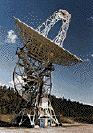
"The Near Earth Network is comprised of tracking stations distributed throughout the world in locations including Svalbard, Norway; Kiruna, Sweden; Weilheim, Germany; Fairbanks, Alaska; Santiago, Chile; McMurdo, Antarctica; Wallops Island, Virginia; South Point, Hawaii; Dongara, Australia; Hartebeesthoek, South Africa; White Sands, New Mexico; and Merritt Island, Florida. The NEN provides Telemetry, Tracking, and Commanding (TT&C) services to an extensive and diverse customer base, which includes approximately 35 missions - from the high-rate Earth Observing System (EOS) missions such as Aqua, Aura, ICESAT, and QUIKSCAT, to Small Explorer (SMEX) missions including GALEX, SWAS, SWIFT, TIMED and TRACE. It also provides TT&C services for an average of 140 passes per day. The polar stations, Kongsberg Satellite SA (KSAT) Svalbard Ground Station (SGS) in Norway and the SSC/USN Alaska Ground Station in Fairbanks, Alaska, provide almost half of the 140 passes per day collectively.

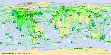
The services provided by the Near Earth Network are primarily for flight missions over short link distances. These missions require daily and sometimes hourly periodic contacts in their orbital and suborbital locations, including Low Earth Orbit (LEO), Geosynchronous Earth Orbit (GEO), lunar, and highly elliptical orbits.

Each of the 140 TT&C supports per day is scheduled from the Data Services Management Center, located at the White Sands Complex in White Sands, New Mexico." ... more
Near Earth Network (NEN) banner
"Satellite Laser Ranging (SLR) is a fundamental measurement technique used by NASA to support both national and international programs in Earth dynamics, ocean and ice surface altimetry, navigation, and positioning. SLR utilizes a global network of stations to measure distances by bouncing very short pulses of laser light off special reflectors installed on satellites orbiting the earth, and also left on the Moon by the Apollo astronauts and Soviet rovers. By accurately timing the round-trip time of flight of these pulses, distances can be computed and precise orbits determined. This data is then used to acquire fundamental information about the geophysical processes of the Earth and the Earth-Moon system."
Image NEN: Kongsberg Satellite Services
Satellite Laser Ranging (SLR)
GSFC has five trailer-based Mobile Laser Ranging Stations (MOBLAS) in operation at fixed sites for over thirty years. Two compact Transportable Laser Ranging Systems (TLRS) are operational at the University of Hawaii and in Peru. In addition, the University of Texas operates a high performing Observatory SLR system at the McDonald Observatory site located in the Davis Mountains of West Texas, which also has lunar ranging capabilities. A prototype Next Generation Satellite Laser Ranging (NGSLR) station is also operational supporting the NASA Lunar Reconnaissance Orbiter around the Moon.

NASA relies on international partners for the foreign sites. The Australians operate MOBLAS-5 in Yarragadee, Australia; the South Africans operate the MOBLAS-6 at Hartebeesthoek Radio Astronomical Observatory in Hartebeesthoek, South Africa; and the University of French Polynesia/CNES operates MOBLAS-8 in Tahiti. Under these partnerships, NASA provides the SLR system, training, engineering support, and parts to maintain SLR operations, while the host country provides the site, local infrastructure, and operating crew.

NASA GSFC was the first to successfully demonstrate laser ranging to satellites in 1964. The NASA SLR Network has been fully operational in the field for over thirty years. During this time, the Network has seen many modifications and upgrades to maintain system operations and more importantly, to increase the quantity and quality of data products. Working as part of the International Laser Ranging Service (ILRS), GSFC has played a crucial role improving ranging precision by a factor of a thousand from a few meters to a few millimeters." ... more
GDSCC
Goldstone Deep Space Communications Complex
Deep Space 1 truster, image CSU
Goldstone Deep Space Communications Complex

"Goldstone is one of three complexes around the world known as the Deep Space Network (DSN) established to provide the ability to communicate with spacecraft; not only in orbit around the earth, but also in the farther reaches of our solar system. The Deep Space Network complexes, placed 120° apart, provide constant communication with spacecraft as the Earth rotates.

In determining the exact position for the site in California, a remote location, free from radio signal interference, was needed. The remote location of the Mojave Desert in California, near the old mining town of Goldstone, was determined to be an optimal location and in 1958 the first antenna was built. Facilities near Madrid, Spain and Canberra, Australia complete the Deep Space Network providing 360 degree coverage for spacecraft tracking.

For over half a century the Goldstone Deep Space Communications Complex (GDSCC) has provided a vital communications link for NASA/JPL manned and unmanned spacecraft. Fifty years of space exploration has seen many milestones in both robotic and manned spacecraft. From the first planetary encounters, the first human landing on the moon, to missions that reach the farthest points in our solar system, the Goldstone Deep Space Communications Complex has been there to bring home the critical data, images, or science.

As missions meet new milestones in the 21st century, the Goldstone Deep Space Communications Complex as part of the Deep Space Network will continue to meet NASA's vision for space exploration. " ... more
CDSCC
The Canberra Deep Space Communication Complex (CDSCC) - also known as the Tidbinbilla Tracking Station - was opened on 19th March 1965. It forms part of the National Aeronautics and Space Administration's (NASA's) Deep Space Network (DSN), that spans the globe. The facilities on this site are similar to the other DSN sites in Goldstone, California and near Madrid, Spain.
DSS-43 (70-metre), image CDSCC
The CDSCC role in space exploration
The role of the antennas can be broken into four key areas; Telemetry, Tracking, Control and Monitor.

The CDSCC acts like a post office. We send and receive packages of information sent between mission scientists and the spacecraft of many nations exploring the planets, moons, and other objects throughout the Solar System.

Telemetry
The purpose of the Telemetry System is to provide the capability to acquire, process, decode and distribute deep space probe and Earth orbiter telemetry data. Telemetry data consists of science and engineering information modulated on radio signals transmitted from the spacecraft. The Telemetry System performs three main functions: Telemetry data acquisition, telemetry data conditioning and transmission to projects and telemetry system validation.

Radiometric Tracking
The purpose of the Tracking System is to provide two-way communication between Earth based equipment and spacecraft, to make measurements that will allow the state vector (position and velocity) of spacecraft to be determined.

Spacecraft Command
The purpose of the Command System is to provide the means by which a Project controls the activities of its spacecraft. Control information (Command Data), provided by the Project, is modulated on the RF carrier and transmitted to a spacecraft by a DSN station. The Command System functions as a transfer medium between the Project Control Centre and its spacecraft.

Monitor and Control
The purpose of the Monitor and Control System is two-fold: to provide real time monitor data to projects which reflect the status of project support by DSN systems, and to provide monitor and control capabilities to operators of DSN systems' components." ... more
The Madrid Deep Space Communication Complex (MDSCC) was opened in 1.965. It forms part of the National Aeronautics and Space Administration's (NASA's) Deep Space Network (DSN), that spans the globe. The facilities on this site are similar to the other DSN sites in Goldstone, California and Canberra, Australia.
image MDSCC
LCRD banner
Image Laser Communications Relay Demonstration
Laser Communications Relay Demonstration (LCRD)
"The Laser Communications Relay Demonstration (LCRD) will demonstrate long-awaited operational capability for a space-based laser communications relay. One of three projects selected by NASA's Office of the Chief Technologist (OCT) for a trial run, the demonstration involves a hosted payload on a commercial communications satellite developed by Space Systems/Loral, of Palo Alto, Calif., and two specially equipped ground stations in California and New Mexico. The demonstration is expected to launch in 2016 and operate for two years. It consists of two optical communications terminals in space and will enable real-time forwarding and storage of data up to 1.25 Gbps (coded) / 2.880 Gbps (uncoded).

Why do we need Optical Comm:
The Laser Communication Relay Demonstration (LCRD) will completely change the way we communicate mission-critical data, video and other information. Future optical communications systems will be able to transmit data at rates 10 to 100 times faster than radio-based communication. For example, at the current limit of 100-Mbps for the Lunar Reconnaissance Orbiter (LRO), it takes a few minutes to transmit a single high-resolution image back to earth. In some instances, this bottleneck can limit scientists' ability to study the moon. An equivalent LRO mission outfitted with an optical communications transmitter would have the capacity to transmit data back to Earth at more than ten times that speed, reducing the single image transmission time to just a few seconds. NASA needs optical communication for this very reason. With missions developing more highly-detailed science and larger volumes of data, radio-based communication links can be overwhelmed by the sheer amount of data being pushed to the ground, providing a need for higher data rates that can only be achieved with optical communication." ... more
LLCD banner
Image LLCD
Lunar Laser Communications Demonstration (LLCD)
"LLCD will be the first high-rate space laser communications system that can be operated over a range ten times larger than the near-Earth ranges that have been demonstrated to date. To be flown on the Lunar Atmosphere and Dust Environment Explorer (LADEE), it will demonstrate high-rate laser communications from lunar orbit to a ground terminal on the Earth. The main goal of LLCD is proving fundamental concepts of laser-based communications and transferring data at a rate of 622 megabits per second, which is about five times the current state-of-the-art from lunar distances.

Why Demonstrate Optical Comm:
In order to make optical communications the norm, NASA needs to first prove that the concept is a viable option for missions. The way NASA proves the concept is through a real-life mission demonstration. After much testing and experiments, NASA greenlighted LLCD, an optical communications test payload to fly aboard the LADEE Spacecraft." ... more
Goddard CDDIS banner
VLBI
The Crustal Dynamics Data Information System
"The Crustal Dynamics Data Information System (CDDIS) supports data archiving and distribution activities for the space geodesy and geodynamics community. The main objectives of the system are to store space geodesy and geodynamics related data products in a central data bank, to maintain information about the archival of these data, and to disseminate these data and information in a timely manner to NASA investigators and cooperating institutions. The CDDIS staff and computer facility are located at NASA GSFC in Greenbelt, MD and is part of the Solar System Exploration Division within the Sciences and Exploration Directorate. The CDDIS is funded by NASA's Earth System Science Data and Services (ESDIS).

The CDDIS has served as a global data center for the International GPS Service (IGS) since 1992. The CDDIS supports the International Laser Ranging Service (ILRS), the International VLBI Service for Geodesy and Astrometry (IVS), the DORIS Pilot Experiment, a precursor to the International DORIS Service (IDS), and the International Earth Rotation Service (IERS) as a global data center."... more
The Space Geodetic Techniques
GNSS - ILRS - VLBI - DORIS
Very Long Baseline Interferometry banner
Image VLBI
Very Long Baseline Interferometry
On the most basic level, Very Long Baseline Interferometry, or VLBI, is a geodetic technique that determines the positions of observing stations (sites) on the Earth by measuring the time it takes a radio wavefront from a quasar (source) to reach pairs of sites. For each pair, as the wavefront travels from the source at a constant rate in all directions, the front will arrive at each site at a different time, yielding differences in position, or distance, between the sites. As these distances are measured over time for a network of sites, site positions and position changes over time can be measured. Other factors must be applied to model complications in observing -- for example, changes in the atmosphere that slow the wavefront down.

The GSFC VLBI group studies the Earth and coordinates the international study of the Earth using the geodetic technique of VLBI. The GSFC VLBI group also supports general solar system exploration by providing data that missions (e.g., Cassini-Huygens and the Phoenix Mars Lander) use in calculating their flight paths." ... more
IDS-DORIS logoThe Extreme Environment Chamber at NASA's Glenn Research Center Image credit: NASA
IDS, International DORIS Service
"DORIS (Doppler Orbitography and Radiopositioning Integrated by Satellite) is a Doppler satellite tracking system developped for precise orbit determination and precise ground location. It is onboard the Cryosat-2, Jason-1, Jason-2, ENVISAT and HY-2A altimetric satellites and the remote sensing satellites SPOT-4 and SPOT-5. It also flew with SPOT-2, SPOT-3 and TOPEX/POSEIDON.

IDS is an international service which provides a support, through DORIS data and products, to geodetic, geophysical, and other research and operational activities. New proposals for Analysis Centers and temporary or permanent DORIS stations are welcome. See the call for participation.

IDS, International DORIS Service site is composed of three parts:
"IDS" describes the organization of the service and includes documents, access to the data and products, event announcements, contacts and links.

"DORIS" allows to access general description of the system, and gives information about the system events and the tracking network.

"Analysis Coordination" provides information and discussion areas about the analysis strategies and models used in the IDS products. It includes also the information about the Combination Center activities. It is maintained by the Analysis Coordinator with the support of the Central Bureau."... more
IDS DORIS Satellites
Cryosat-2 - Jason-1 - Jason-2 - Envisat - HY-2A - Spot-4 - Spot-5
GDGPS banner
Image JPL - GDGPS
The NASA Global Differential GPS (GDGPS) System
The NASA Global Differential GPS (GDGPS) System was developed at the Jet Propulsion Laboratory (JPL) in support of NASA's demanding terrestrial, airborne, and spaceborne operations, and for other Government and commercial customers. JPL is a Division of the California Institute of Technology (Caltech), which manages the laboratory for NASA. JPL is NASA's lead center for robotic exploration of space, and is responsible for technology development and operations of many NASA missions and infrastructure.

With nearly 60 GPS engineers and scientists working in this field, JPL is one of the biggest GPS and GNSS R&D laboratories in the world, with an unparalleled track record of innovations and leadership in GPS technology and its advanced applications. End-to-end GPS expertise includes: systems, software, hardware, infrastructure, flight experiments, operations, and science

The GDGPS System is managed and operated in the Tracking Systems and Applications Section of JPL's Telecommunications Division." ... more
Banner GSFC Search and Rescue
Image DASS
GSFC Search and Rescue Mission Office

"The National Search and Rescue Plan updated and signed by participating parties, including NASA in 2007, states that "NASA will support Search and Rescue (SAR) objectives through research and development or application of technology to search, rescue, survival, and recovery systems and equipment, such as location tracking systems, transmitters, receivers, and antennas capable of locating aircraft, ships, spacecraft, or individuals in potential or actual distress

Tech Development
The NASA Goddard Space Flight Center's Search and Rescue Mission Office is responsible for research and development activities in the areas related to the Distress Alerting Satellite System (DASS), Emergency Beacon Development and "Beaconless" Search or Remote Sensing.

NASA in cooperation with the Department of Defense (DOD) and Sandia National Laboratories (SNL) has undertaken the development of the Distress Alerting Satellite System (DASS) and has selected the GPS constellation as the best mid- earth orbiting (MEO) satellite constellation to host the search and rescue instruments. NASA has committed funds for the development of a proof-of-concept system for DASS and the installation of a proof-of-concept ground station at the Goddard Space Flight Center (GSFC) in Greenbelt, Maryland."... more
Other Related and Util Links
NOAA-SARSAT - GOES - Cospas-Sarsat - Emergency Beacons
logo DESCANSO
Image DESCANSO
DESCANSO - Deep Space Communications and Navigation Systems
"PROVIDE technical leadership in the planning and implementing of an integrated vision for the future of deep space communications and navigation
       -  Develop a coordinated vision with program offices, from a NASA perspective
       -  Create and maintain technology roadmaps consistent with developed vision and end-to-end trade analyses

IDENTIFY, promote, and advocate innovative concepts, systems, and technology
       -  Increase focus on innovation and breakthroughs
       -  ;Advocate/broker potentially high pay-off developments for accelerated infusion into missions
       -  Lead/Co-lead study/working groups on key technical issues
       -  Stimulate leading-edge applied research critical to future mission scenarios
       -  Identify and facilitate R&D partnerships and information exchange within JPL, NASA, industry, academia and other external organizations

FOSTER improved engineering capabilities and resources
       -  Support the acquiring and maintaining of world-class personnel and their skills
       -  Enhance the technical infrastructure: processes, tools, labs, ...."... more
Other Related and Util Links
NASA Integrated Services Network (NISN)
Banner TMO Progress Report
The Interplanetary Network Progress Report
"The Interplanetary Network Progress Report, published by the Jet Propulsion Laboratory, reports principally on activities of the Interplanetary Network Directorate (IND) in planning, research, technology development, implementation, and operations in the areas of network, communications, navigation, information systems, Deep Space Network (DSN) science, mission support, communication standards, protocols, and spectrum engineering. Tasks funded by the JPL Director's Research Discretionary Fund, the Research & Technology Development Fund, and other programs that involve the IND also are included."... more
Clic for your Research of books on Amazone about: Space
Amazone : Astrophysic - Astronautic - Astronomy - Space Astronomy
Directories : Yahoo: Science - Space - News and Media
MSN: Space News - Demoz: Science - Space - News and Media - Astronomy
CSS Valide !CSS Valide !
Copyright WaoLine, The Internet Interactive and Dynamic Visual Directory